When satellite positioning cannot be used in the indoor environment, indoor positioning system technology is used as an auxiliary positioning for satellite positioning to solve the problem that satellite signals are weak and cannot penetrate buildings when they reach the ground. Finally locate the current position of the object.
1. Definition of Indoor Positioning System
Indoor positioning system refers to the realization of position positioning in the indoor environment. It mainly uses wireless communication, base station positioning, inertial navigation positioning, motion capture and other technologies to integrate to form a set of indoor position positioning system, so as to realize the positioning of people and objects in indoor space. location monitoring.
2. Positioning technology of indoor positioning system
In addition to the cellular positioning technology of the communication network, common indoor wireless positioning technologies are: Wi-Fi, Bluetooth, infrared, ultra-wideband, RFID, ZigBee, motion capture [5] and ultrasonic.
2.1 Wi-Fi technology
Through the wireless local area network (WLAN) composed of wireless access points (including wireless routers), positioning, monitoring and tracking tasks in complex environments can be realized. Based on the location information of network nodes (wireless access points) and premise, it uses a combination of empirical tests and signal propagation models to locate the connected mobile devices with a maximum accuracy of about 1 meter to 20 meters. between meters. If the positioning calculation is only based on the currently connected Wi-Fi access point, instead of referring to the signal strength composite map of the surrounding Wi-Fi, the Wi-Fi positioning is prone to errors (for example, the location of the floor is wrong).
In addition, Wi-Fi access points usually only cover an area with a radius of about 90 meters, and are easily interfered by other signals, which affects their accuracy, and the energy consumption of the locator is also high.
2.2 Bluetooth Technology
Bluetooth communication is a short-range and low-power wireless transmission technology. After installing an appropriate Bluetooth LAN access point indoors, configure the network into a multi-user-based basic network connection mode, and ensure that the Bluetooth LAN access point is always this The master device of the micro network. In this way, the location information of the user can be obtained by detecting the signal strength.
Bluetooth positioning is mainly used for small-scale positioning, such as: single-storey halls or warehouses. For a mobile terminal device with integrated Bluetooth function, as long as the Bluetooth function of the device is turned on, the Bluetooth indoor positioning system can determine its location.
However, for complex space environments, the stability of the Bluetooth positioning system is slightly worse, and it is greatly interfered by noise signals.
2.3 Infrared technology
Infrared technology indoor positioning system is to use optical sensors installed indoors to receive the modulated infrared rays emitted by each mobile device (infrared IR logo) for positioning, which has relatively high indoor positioning system accuracy.
However, since the light cannot pass through the obstacles, the infrared rays can only propagate at the line of sight, and are easily interfered by other lights, and the transmission distance of the infrared rays is short, so that the indoor positioning system effect is very poor. When the mobile device is placed in a pocket or blocked by a wall, it cannot work properly, and a receiving antenna needs to be installed in each room and corridor, resulting in a higher overall cost.
2.4 UWB Technology
The positioning method of UWB technology is quite different from that of traditional communication technology. It does not need to use the carrier in the traditional communication system, but transmits data by sending and receiving extremely narrow pulses with nanoseconds or less, which can be used for Indoor precise positioning, such as: location discovery of soldiers on the battlefield, robot motion tracking, etc.
Compared with the traditional narrowband system, the ultra-wideband system has the advantages of strong penetration, low power consumption, good anti-multipath effect, high security, low system complexity, and can improve the precise positioning accuracy. It is usually used for indoor moving objects. location tracking or navigation.
2.5 RFID Technology
RFID positioning technology uses radio frequency to conduct non-contact two-way communication to exchange data to achieve the purpose of mobile device identification and positioning. It can obtain centimeter-level positioning accuracy information within a few milliseconds, and has a large transmission range and low cost; however, because the following problems cannot be solved, the scope of application of RFID positioning technology is limited.
2.5.1 RFID is not easy to integrate into mobile devices
2.5.2 The action distance is short (usually the longest is tens of meters)
2.5.3 User security and privacy protection
2.5.4 International Standardization
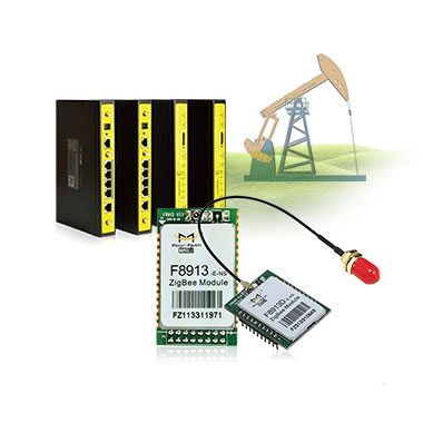
2.6 ZigBee Technology
ZigBee is a short-range, low-speed wireless network technology. It is between RFID and Bluetooth, and can locate the location of the device through the coordinated communication between the sensors. These sensors require very little energy to relay data from one sensor to another via radio waves, so ZigBee's most notable technical features are its low power consumption and low cost.
2.7 Ultrasonic technology
Ultrasonic positioning mainly uses reflective ranging (after transmitting ultrasonic waves and receiving echoes generated by the measured object, the distance between the two is calculated according to the time difference between the echoes and the transmitted waves), and the distance of the object is determined by algorithms such as triangulation. Location.
Ultrasonic positioning has high overall positioning accuracy and simple system structure, but it is easily affected by multipath effects and non-line-of-sight propagation, reducing positioning accuracy; at the same time, it also requires a lot of investment in underlying hardware facilities, and the overall cost is high.
2.8 Motion Capture Technology
The NOKOV motion capture system belongs to visual positioning. It covers the capture area of ??the indoor space through the motion capture lenses arranged in the space, and accurately captures the three-dimensional space position of the reflective markers (Markers) placed on the capture target. After the sum operation, the system can obtain the three-dimensional space coordinates (X, Y, Z) of the reflective marker point; it can also set the rigid body of the target object, and further process and calculate the data through professional analysis software, and the precise position and attitude of the target object can be obtained. et al., [2] [5] [7] for scientific research.
2.9 Indoor space navigation and positioning
On March 20, 2022, China's largest indoor space navigation and positioning system, the Metro Beidou positioning system, started construction on the Beijing Metro Capital Airport Line. In the subway, the combination of indoor and outdoor is used, Beidou is used in the outdoor exposed space, and Beidou's enhanced technology is used to achieve high-precision positioning. Indoors, the deployment of this positioning base station and technology integrated with 5G can be achieved. The broadcast of indoor positioning system signals enables users to receive navigation and positioning signals to achieve high-precision positioning.
3. Service provider of indoor positioning system
Indoor positioning system technology is mainly divided into three service providers: base station positioning, motion capture and inertial navigation positioning. Base station positioning service providers mainly include: Google, Nokia, TI, Apple, AutoNavi, Baidu, etc. using WIFI positioning; inertial navigation positioning service providers mainly include: NAVISEER in the United States, Longqi Ruipu Technology, and Shanghai Fire Research Institute. Commercial technology basically adopts wireless communication base station solutions such as WIFI and RFID, and mainly adopts technical solutions such as inertial navigation for emergency rescue, because the places faced by emergency rescue should be disastrous, and the wireless communication of base stations is in a state of paralysis. The cost is too high, so inertial navigation technology can only be used. It does not require any additional infrastructure or network, and wirelessly outputs the walking distance and direction information of personnel in real time, which can realize accurate positioning of personnel in various complex environments. Provide an effective guarantee for the safety of personnel.
For scientific research projects that require high-precision indoor positioning system, the NOKOV metric motion capture positioning technology solution is mainly used. In addition to simplifying the process of modelling and model verification of the measured target, the motion capture system can also be used as the true value of higher order of magnitude accuracy for other Research provides a reference standard.
4. Technical scheme of indoor positioning system
4.1 Google Solution
When Google Maps for mobile phone version 6.0, the indoor navigation function has been added in some areas. This solution mainly relies on GPS (2 to 3 satellites can also be searched indoors), wifi signal, mobile phone base station and according to some "blind spots" (no indoor The specific location of GPS, wifi or base station signal) completes indoor positioning system. The accuracy of this solution is not very satisfactory, so Google later released a mobile application called "Google Maps Floor Plan Marker", calling on users to follow certain steps to improve the accuracy of indoor navigation.
Google has been trying to solve two problems: getting more floor plans; and improving the accuracy of indoor navigation. Building plans are the basis for indoor navigation, just as GPS car navigation requires electronic navigation maps. Google wants to solve the problem of data sources through "crowdsourcing", which is to encourage users to upload floor plans. In addition, when users use Google's indoor navigation, Google will collect some GPS, wifi, base station and other information, and provide users with more accurate positioning services after processing and analysis through the server.
4.2 Nokia Solution
Nokia uses HAIP technology, but Nokia is working to make it part of the Bluetooth protocol, so as long as your device has a Bluetooth module, you can use this technology for positioning. Of course, only one Bluetooth module cannot complete the positioning, and a positioning transmitter needs to be installed indoors to complete the positioning through the communication between the two. This launch pad can cover a range of 100m × 100m, and the positioning accuracy is 30cm to 100cm. It is said that this launch pad has the characteristics of low cost and low power consumption, and one or more can complete the positioning.
5. Prospect analysis of indoor positioning system
5.1 The Prospect of Indoor Positioning System Technology
5.1.1 The future is the era of mobile internet
5.1.2 Opportunity for Mobile Services Last Meter
People spend an average of 80% of their time indoors, and 80% of their mobile phone usage and data connections are used indoors.
5.2 Demand for indoor positioning system
5.2.1 Public Safety and Emergency Response
In an emergency, everyone wants to be pinpointed by rescuers, down to the location of a building, or even a floor or room number.
5.2.2 Orientation guide
(1) What is in this building.
(2) Who is around my office.
(3) Where is my car in the underground parking lot?
(4) Where is the milk in the supermarket.
(5) Where is the nearest restaurant in the large shopping mall.
(6) HOW TO GET THERE.
5.2.3 Social needs
Realize business card exchange, Weibo push, make friends and interact like WeChat, etc.
5.2.4 Marketing demand
Provide shopping guide services for customers in department stores. The mobile phone will tell you, provide shopping guide services, and which products are discounted nearby.
In tourist attractions, exhibition halls, airports, realize positioning guide, introduce exhibits, etc. At the airport, it can accurately guide users to go through procedures, indicate the location of toilets, and so on.
5.2.5 Big data application of valuable data
6. The basic principle of RFID positioning of indoor positioning system
The basic principle of RFID positioning is to read the characteristic information (such as identity ID, received signal strength, etc.) of the target RFID tag through a set of fixed readers, and the nearest neighbor method, multilateral positioning method, received signal strength and other methods can also be used to determine the tag. location.